Wednesday, August 31, 2011

Alliance Focuses on Milestones Marking History of American Transportation

By Haley Wilcox

At the start of the 18th century, while Massachusetts was under Colonial rule, Parliament took legislative action to survey and improve post roads. This resulted in placing milestones throughout the Commonwealth in the mid-1700s. Ninety-nine rectangular or round-headed monoliths were inserted at mile intervals along Old Post Road (now Route 20), stretching from Boston to Springfield. As the traveler neared Boston, the markers counted down the distance to Boston City Hall. 

Of the original ninety-nine stones statewide, forty-seven still stand, including four in Boston. 
In 1940, recognizing them for their historic significance, the Works Progress Administration inventoried and described the stones, publishing their findings in Milestones and Markers in Massachusetts. In 1960, the Massachusetts legislature directed the Department of Public Works to preserve the stones. In the 1970s, the stones were added to the National Register of Historic Places.

The stones have seen great changes in the Commonwealth as the communities around them urbanized and country roads were transformed into major thoroughfares. Some stones have been relocated to save them from destruction and protect them from the wear and tear associated with heavily trafficked areas. Several still stand in their original location, including one at 144 Harvard Avenue, in the heart of Allston Village that was recently damaged by a truck.


The stone juts from the sidewalk between a hardware store and grocery store. Over the years it has seen Allston transform from a sleepy part of Cambridge to a thriving, unique neighborhood of Boston (Allston was annexed by the City in 1874). The neighborhood is alive with students, long-term residents, and a diverse population of immigrants.

The stone, just under three feet high, is carved to read “Boston/ 6: miles/ 1729/ PD.” As with most other milestones in Massachusetts, it contains initials which indicate who erected it. In this case, “PD” stands for Chief Justice Paul Dudley, who erected all the stones in Boston. Over the centuries, the stone weathered substantially but was largely intact until the accident severed it at its base. The stone has since has been temporarily reset, and is currently surrounded by a barricade to protect it from further damage. The Boston Preservation Alliance has advocated not only for its repair, but for its long-term protection.

One option that has been considered is the stone's relocation. But while this option would protect the stone from future accidents, removing it from its historical context would rob Allston Village of this humble reminder of its past. Another option under consideration, which has been applied to several milestones in Massachusetts, would be to restore it in place and framed with low walls or fences for protection. The Alliance looks forward to assisting city and state agencies in any way that we can.

Thursday, July 7, 2011

Two Fenway Icons Accepted for Further Study as Boston Landmarks

The Alliance has supported petitions to designate two of the Fenway’s most valued historic buildings—Symphony Hall and Horticultural Hall—as Boston Landmarks. The petitions were submitted by community residents and were accepted for further study by the Boston Landmarks Commission on June 28.

Symphony Hall

Symphony Hall, at 301 Massachusetts Avenue and completed in 1900, is a first of its kind, the product of tedious scientific testing, careful calculation, and collaborative interdisciplinary planning. The influential structure effected the construction of musical venues across the country and internationally.

Built specifically for the Boston Symphony Orchestra from 1899-1900, the structure provided a space better fit for the orchestra’s performances. Henry Lee Higginson, the founder of the BSO, helped put together a team of renowned architects, scientists and acoustic specialists to design a cutting edge performance space. Prominent architects McKim, Mead & White, renowned for designs such as the Boston Public Library, the New York Public Library, and the National Museum of American History in Washington, D.C., joined a team that included Harvard physics professors Wallace Clement Sabine and Charles Robert Cross, both acoustics specialists.

The interior of the hall, down to its pilasters and statues, was designed to produce the highest possible quality acoustic conditions. The statues, coffers and carvings served to break up sound waves, preventing reverberation of echoes into the audience’s listening space. The parallel walls and horizontal ceiling within auditorium enhance the sound of the music. Aside from the technological advances, Symphony Hall also houses a fine collection of artwork and incorporates local materials. The statues the line the auditorium walls were cast by the Boston artist, Pietro Caproni. The structure is laid with Bedford limestone trim, and the base is made from Quincy granite, linking the hall with other buildings throughout the city.

Symphony Hall's significance also stems from its association with world class musical performance and composition. During its fiftieth anniversary season in 1930-31, an astonishing twelve different pieces were commissioned by the house orchestra, some of which have become masterpieces of the century. Roland Hayes, who made his debut with the BSO at Symphony Hall in 1917, became the first African American ever to perform with a symphony orchestra in the country.

Horticultural Hall

The Massachusetts Horticultural Society, founded in 1829, is the oldest society of its kind in the United States. Throughout the centuries, it has greatly affected the landscape of Boston by pioneering the garden cemetery movement in 1831 at Mount Auburn Cemetery, which still stands as a lush and peaceful retreat for the city. The Society also championed the school garden movement in the 1880s, the victory garden movement during World War II, and promoted home gardens to adorn Boston’s back alleys in the 1930s. Aside from these influential movements, the Society has continuously served to educate the public about the local plants and flowers of Massachusetts, holding weekly shows, free and open to the public, at its three headquarters.

Constructed in 1901, Horticultural Hall, at 1154 Boylston Street, was designed by Edmund M. Wheelwright, who also designed several Boston hospitals, schools, the New England Conservatory, the Park Street MBTA head houses, and the Harvard Lampoon Building in Cambridge, and is a beautiful example of turn-of-the-century Renaissance Revival style. Finished one year after the completion of Symphony Hall, the structure was built using materials that complement its neighbor, including the same red brick, Bedford limestone, and Deer Island granite. Horticultural Hall’s detailed ornamentation speaks to its use,  including gatherings of fruits and flowers and marble medallions referring to the flower and plant shows that occurred in the hall.

Horticultural Hall is not only an architecturally integral part of the Fenway and Back Bay neighborhoods, but also serves as a monument to one of the city’s most prominent and influential organizations. Still in operation, the Massachusetts Horticultural Society now boasts over 5,500 members, and continues to educate and encourage the public on the enjoyment and understanding of plants and the environment.

The Fenway neighborhood is home to some of the city's most important cultural institutions and the buildings that house them. The Alliance supports landmark designation of many of these properties, including Symphony Hall and Horticultural Hall, but also recognizes that, should they be designated, design guidelines will need to provide ample flexibility to allow the buildings to evolve to meet future needs.

Thursday, June 23, 2011

Alliance Researches Boston's Modern Hospitals

By Michelle Oliver Gutierrez

On Monday, June 13, 2011 the Boston Preservation Alliance presented the findings of a “reconnaissance” survey of some of Boston’s Modern hospitals at Docomomo/New England’s monthly meeting. The study focused on five hospital complexes that showcase the Modernist aesthetics for which Boston has become well-known, especially smooth concrete and glass facades.

The Alliance has engaged in this research in an effort to raise awareness about Boston’s exceptional Modern architecture and to deepen public understanding of the ways in which these buildings tell stories of the social changes, technological advancements and aesthetic preferences during the era in which they were constructed. The Alliance understands that in order to provide the best possible medical care Boston’s Hospitals must evolve and regularly upgrade their facilities. Our research aims to identify some of the unique features of the city’s Modern hospital buildings in an effort to better inform decisions about changes to them. In so doing, we hope that change can be managed in ways that reinforce the stories the buildings have to tell about the hospitals’ pioneering, internationally-recognized advancements in medicine, science and patient care.

The design of hospitals during this time placed an unprecedented focus on patient comfort, incorporated new technologies, especially in telecommunications and efficient internal transportation systems, and expected future developments and expansions by abandoning the traditional vertical zoning of functions in favor of the horizontal. While the Modern exteriors of these buildings are mostly unchanged since their construction, little remains of the original interiors, which have been replaced with the latest in contemporary hospital design.

A typical example of early 1950s Modernism, the Veteran’s Affairs Hospital in Jamaica Plain (1951-1952) was designed by the US Army Corps of Engineers, supervised by Col. H.J. Woodbury and resident engineer J.E. Eklund. The steel-frame building is clad in corrugated metal, and rises to thirteen stories. The design of the building ensured that every room received natural light, and incorporated an array of services including libraries, shops, recreation halls, a chapel, occupational therapy rooms, a dining hall and canteen, as well as a broadcasting room. Apart from the three-story addition in 1999 by Payette Associates, the original ambulatory care facility has remained largely unchanged, and is beginning to show signs of aging.

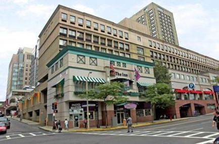
Between 1958-1976, The Architects Collaborative, headed by the famed Walter Gropius worked on the long-range planning and design of several buildings for two major hospitals in Boston, The Children’s Medical Center in Longwood and Tufts Medical Center in Chinatown. The work by The Architects Collaborative is easily distinguishable from earlier buildings on the medical center campuses by its extensive use of cast concrete.
At the Children’s Medical Center, these buildings include the Fegan out-patient tower (eleven stories, 1967), John F. Enders Pediatric Research Laboratory (fifteen stories, 1970), and The Children’s Inn, a multi-facility complex that included the twenty-five story apartment tower, a six-story motel and a large public plaza (1968). As one of the most incompatible changes to the complex, the subtle architectural drama that the original buildings achieved in the Children’s Inn has been obscured by the flashing colors of the recently added Food Court, and the encrustation of a standard Best Western façade.

At the Tufts Medical Center, the two modern buildings are the School of Dental Health (1972), and Proger out-patient center (1973). A large five-story vertical addition to the School of Dental Health was completed in 2010 by Architectural Resources Cambridge, along with a new entrance to the center. In its 2010-2020 Master Plan, Tufts proposed the demolition of several older buildings adjacent to Proger, as well as a complete redesign of the buildings’ Washington Street façade to “activate the pedestrian realm” by the use of a variety of colors, and textures placed over the fire existing concrete surfaces.

Perhaps most striking in their development of completely flat exterior surfaces of unbroken concrete and glass horizontal planes are two buildings by different incarnations of the Perry, Dean and Partners firm: the Faulkner Hospital in Jamaica Plain by Perry, Dean and Stewart (1968-1976) and the Massachusetts General Hospital’s Barbara and Melvin Nessel Cancer Services building on Storrow Drive, designed by Charles Rogers for Perry, Dean, Stahl and Rogers (1969-1975).
Construction of the new Faulkner Hospital was enveloped in controversy from the beginning. Strong opposition to the scale of the development by neighbors who felt the development was out of scale with the single story, residential context delayed the project by thirty-one months of legal battles. Costing twice as much as was originally estimated, when the Faulkner finally did open, severe financial difficulties put the future of the newly constructed hospital into serious question. The Faulkner’s design was revolutionary in following the ideas proposed by the architect Gordon Friesen, who called for exclusively single-patient rooms, and did away with nurses’ stations replacing them with smaller supply closets (Nursevers) in every room. Extremely luxurious and spacious, the hospital used to feature a large roof-deck and airline-style galleys on every patient floor.

MGH’s eight-story Cancer Services building, originally the William G. Cox Cancer Management Center until 1997, is an excellent study in showcasing the possibilities of different materials. The building is defined by five modules of concrete and glass, and four large metal columns. It is set diagonally on a base of red brick that fans out to create seating space along the building, and eventually rises into an undulating brick wall. Apart from the rounded brick, other great details include rounded glass at the corners of the building, exposed piping on the inside, and concrete beams that protrude past the columns so that the joints of the building can be read from the outside.

For more information about the Alliance’s work relating to Modern building advocacy, please contact Sarah D. Kelly, executive director, at skelly@bostonpreservation.org.

Tuesday, May 31, 2011

Fraunhofer Center Breaks Ground at Historic Fort Point Building

By Haley Wilcox

In its industrial prime, Midway Street in Fort Point was filled with warehouses, many of which stored wool that was manufactured in Boston and Western Massachusetts and shipped worldwide. At that time, Boston was the international leader in textile production, and the fully stocked warehouses of what is now Boston’s Fort Point Channel Landmark District were bursting at the seams.

The wool may be gone, but the area still recalls its industrial past, as many warehouses are being adapted for commercial and residential use. Under a new moniker of Channel Center, Midway Street is being redeveloped as a mixed-use project consisting of over 200 residences and 1.1 million square feet of new and restored office and retail space. GE Asset Management, CB Richard Ellis Group, and Commonwealth Ventures are all working together to create “the ultimate mixed-use community in Boston’s newest neighborhood.”

In tune with the theme of innovation, Fraunhofer Center for Sustainable Energy Systems recently broke ground on a 50,000 square foot research facility at 5 Channel Center. Founded in 2008, the Fraunhofer CSE will work closely with Fraunhofer Institute for Solar Energy Systems and MIT in the area of solar technology and energy-efficient building.

The building itself will serve as a showcase for the technologies, illustrating how sustainability can be applied to historic structures. With the necessity of sustainable building growing exponentially over the years, Fraunhofer CSE will be contributing research which will greatly benefit the field of sustainability with respect to new and historic structures. The research center will serve as a model for sustainable adaptive reuse, providing an example for a field which is becoming more and more valued amongst historic preservation advocates. It is also a prime example of Mayor Menino’s success in launching Boston’s Seaport Innovation District.

The Boston Preservation Alliance has supported the project at 5 Channel Center before the Fort Point Channel Landmark District Commission and as a candidate for Historic Rehabilitation Tax Credits. We look forward to the project’s completion and the building’s occupancy for a use that undoubtedly will bring more activity to this emerging area.

Alliance Advocates on Behalf of William Lloyd Garrison House in Roxbury

By Haley Wilcox


Framed by weathered stone retaining walls and boulders, the William Lloyd Garrison House, known as ‘Rockledge,’ sits atop a tree-filled slope. It is a surprisingly pastoral setting in the otherwise dense residential area of Roxbury Highlands. From its rambling surroundings to its crisp architectural detail, one can easily see that this house has a special story to tell.

Constructed in 1854, the Italianate structure was the home of William Lloyd Garrison, a prominent abolitionist and journalist, who campaigned tirelessly to end slavery in the United States. A co-founder of the American Anti-Slavery Society, Garrison founded and edited The Liberator, an abolitionist newspaper that circulated from 1831 until slavery was abolished in 1865. The Liberator was unabashed in its insistence on the “immediate and complete emancipation of all slaves,” a principle that met with vigorous resistance in all parts of the country until the 1850s. In the South, state legislators mandated financial rewards for the identification of anyone who distributed the paper. In Boston, Garrison was nearly lynched by a mob in October of 1835, when he prepared to speak at a meeting of the Boston Female Anti-Slavery Society. Prominent merchants teamed up with local hoodlums in a violent protest of the meeting. Garrison was dragged through the streets and was saved only by being thrown in jail. After slavery was abolished, Garrison retired to Rockledge for the remainder of his life.

The home is one of fewer than 2,500 National Historic Landmarks nationwide and has been listed on the State and National Registers of Historic Places, as well as on the Inventory of Historic Assets of the Commonwealth. It is a contributing structure to the Roxbury Highland Historic District, which was listed on the National Register in 1988 because of the area’s role in the Revolutionary War, its assortment of late eighteenth to early twentieth century buildings, and its significance as one of Boston’s first “Streetcar Suburbs.”

Despite the structure’s nationally recognized significance, the future of the Garrison House is uncertain. Up until this year, the Society of St. Margaret’s, an order of Episcopal nuns, owned the property, converting an old nursing home to a sprawling 35,000 square foot convent. As the order dwindled, however, the large building proved too difficult to maintain and the seventeen remaining nuns decided to relocate to a retreat center in Duxbury.

Bridge Boston, a new charter school, planned to purchase the grounds and adapt the site for the needs of approximately 400 students and teachers. This would have required a paved double bus entrance, a vehicular drop-off site, and walkways cut through the hilly grounds. In order to construct the bus lanes, heavy excavation of the front lawn, plus the demolition of the historic retaining wall, would have been necessary, which would have severely compromised the bucolic character of the surroundings. In addition, the school planned to construct a paved play ground on the property, further diminishing the existing natural landscape.

While the Alliance fully supports the objectives of Bridge Boston, the plans for renovation would have greatly altered this historic site. The Alliance urged the school to consider alternative plans that leave the historic landscape intact.

In early May 2011, Bridge Boston announced that the site would not accommodate their needs as a school and decided to rent space in Jamaica Plain, leaving the property up for sale. The Alliance hopes to work with community residents and the Society of St. Margaret’s to ensure that any future redevelopment plans will recognize the significance of the property and leave its rich historic character intact.

Monday, April 4, 2011

Alliance Advocates for Massachusetts Eye and Ear Infirmary Parking to be Returned to Parkland

The Massachusetts Eye and Ear Infirmary (MEEI) unveiled a ten year Institutional Master Plan to guide its growth and change. The plan proposes a new four-story building on the parking lot adjacent to the John Jeffries House, the demolition of four buildings on Cambridge Street (one of which dates to 1889) to make room for a new ten-story building, and an addition/renovation to the main building at 243 Charles Street.

The Alliance has requested additional information regarding the proposed demolition. The Alliance has also supported The Esplanade Association in requesting that MEEI consider turning some of its parking lot area along the Charles River back to parkland. This change would provide additional green space in close proximity to the newly landmarked Charles River Esplanade and the Charles River Basin, which is listed on the National Register of Historic Places, and is one of Boston's most well-loved and well-used recreational and historic resources. It would also improve the setting for the approach to the Longfellow Bridge in concert with its planned rehabilitation.

MEEI has voiced its desire to work openly with residents of the surrounding neighborhoods on the revision of its ten-year plan.

Thursday, March 24, 2011

Anderson Memorial Bridge to undergo restoration by MassDOT


As part of the Commonwealth’s $3 billion Accelerated Bridge Program, the Massachusetts Department of Transportation (MassDOT) is undertaking the rehabilitation of the historic Larz Anderson Memorial Bridge, a historically and architecturally significant feature of the Charles River landscape. The bridge, constructed in 1915, is in severe disrepair and is currently a safety hazard, due to crackling concrete, loose or missing bricks, and arches which are structurally compromised.

MassDOT is planning repairs which follow the Secretary of the Interior’s “Standards for the Treatment of Historic Properties.” These plans include the repair and replacement of spandrel walls, parapets, and concrete arches. MassDOT will work closely with the Massachusetts Historical Commission as the project progresses.


The project also includes plans to increase pedestrian and cycling space across the bridge by widening the pedestrian/bike path. Some advocates have pushed for adding a boardwalk-style pedestrian underpass on both sides of the river, as part of the heavily-used network of paths of the Charles River Esplanade. The Alliance has supported exploration of this alternative, although we have expressed that its design would have to be sympathetic to the historic bridge. The plan also includes landscaping design, in which invasive trees near the bridge will be replaced with native species. The Alliance is supportive of the plan for the bridge’s rehabilitation, and looks forward to the project’s commencement.

Monday, March 14, 2011

Alliance Pushes Preservation Planning for Huntington Avenue YMCA


The Boston Preservation Alliance has been monitoring and participating in review of proposed changes to the Huntington Avenue YMCA.

The prominently located, iconic Administration Building and Hastings Wing are part of a cluster of turn of the twentieth century buildings in the area. They speak to the substantial institutional development that occurred along Huntington Avenue and its surroundings during this period. Retaining much of their original appearance, these buildings handsome examples of Shepley Rutan and Coolidge’s work in the Tapestry Brick Style with character-defining ornamental detailing. The administrative activities that these buildings have housed over time also lend them significance, as the headquarters of the regional YMCA which was a leader in the provision of recreational and social services to its members.

A third building, a gymnasium, is proposed for sale to Northeastern University for the construction of a new dormitory tower in partnership with Phoenix Property Company. While the building helps to tell the story about the YMCA's philosophies about health and exercise, and it's leadership in social and demographic integration in the city, it is also in a deteriorated condition. It is adjacent to New England Conservancy's Jordan Hall, which recently underwent a major restoration.

On Tuesday, March 8, the Boston Landmarks Commission imposed a 90-day delay on the demolition of the gymnasium in accordance with Article 85 of the Boston Zoning Code. The Alliance has urged the YMCA and Northeastern to use this time to collaborate on a preservation plan for the complex that will outline what measures will be taken in order to protect the most important buildings on the site and commemorate YMCA's rich history. The Alliance looks forward to working collaboratively with both institutions and with community residents as plans move forward.

New Long-Term Stay Hotel Signals Historic Fort Point's Bright Future


The Fort Point Channel Boston Landmark District is well on its way to becoming one of Boston’s most vibrant neighborhoods. With a still thriving arts scene and growing residential community, the area also borders the city's emerging Seaport District and burgeoning Innovation District.

The Alliance is supporting the rehabilitation of the Stillings Building, located at 368 Congress Street, for an extended-stay hotel. The six-story, turn-of-the-century warehouse was built in the Classical Revival Style in 1901 by Morton D. Safford, chief architect for the Boston Wharf Company. The building features a highly ornamented exterior, and a unique, glazed tile central atrium with iron walkways which rises six stories and provides natural light to all floors of the building. Criss-crossed by steel bridges that connect the east and west sides of each floor, and topped with a massive skylight, this atrium is a reminder of the building’s industrial past, and will remain a prominent feature of the restored structure.

The extended-stay hotel will include a ground floor lobby, restaurant, and retail space. In addition to the high quality of restoration proposed for the building’s exterior, the project includes sensitive new interventions that are in keeping with the industrial history of the area.

Fort Point Channel was developed from 1836 to 1882, almost entirely by the Boston Wharf Company. The area’s warehouses, originally used for sugar, molasses, and wool storage, now comprise Boston’s largest and most significant collection of industrial lofts. After the manufacturing and storage uses declined, artists moved into the abandoned lofts in the 1970s, creating what is now the largest artist enclave in New England.

The development team consists of Norwich Partners of Boston, LLC as the proponent; Colliers International as the development manager; Group One Partners, Inc. as the project architect; McCarter & English and Brennan, Dain, Le Ray, Wiest, Torpy & Garner as legal counsel; Howard Stein Hudson as transportation consultants; and Lee Kennedy & Company as construction managers. This project, which is being embraced by the Fort Point community, will bring more vitality and activity to the area, promising its continued revitalization.

WPA-Era Stone Wall in Mission Hill to be Restored


Nestled among the turn-of-the-century townhouses and triple-deckers, a small, humble relic tells a story from a different time in the history of Mission Hill. It is a story of the neighborhood, and the city, rising out of the Great Depression.

Around 1935, Franklin Delano Roosevelt’s New Deal initiative resulted in an ambitious agency called the Works Progress Administration. The goal of the agency was to provide employment in a time of national economic strife, and in the process, provide public works for the enjoyment and improvement of cities across the country. From constructing new roads and recreational buildings, to overseeing large art and literacy projects, the WPA provided employment for nearly eight million Americans. Among the many WPA projects in the Boston area, the Sachem Street Wall was constructed to act as a visual connector of several irregularly shaped housing lots along Sachem Street, making the street more visually appealing.

The stone wall is only about four feet high, but over the years it has become much-loved feature of Mission Hill. Constructed of curving river stones and crowned with wedges of granite, the wall now shows signs of wear and tear. Weathering, deferred maintenance, and vandalism have all contributed to its deterioration. Fortunately, the City of Boston has allocated funds for repairs to the wall.

The Alliance has been working closely with the Friends of Historic Mission Hill and others from the neighborhood to ensure that the wall is restored in a historically sensitive and timely manner. Anticipated repairs are set to begin in early Spring, 2011.